In the next 12-24 hours, Nuri is expected to move the west-northwestwards, northwestwards at its speed of 20-25 kilometers an hour before turning into a low- pressure zone in the mainland of Guangdong, Guangxi provinces.
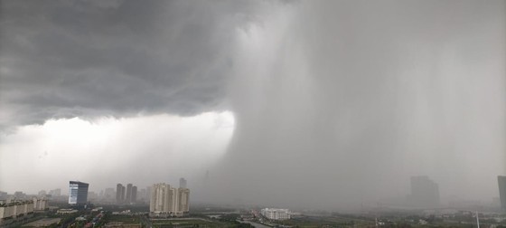
According to Deputy Director of the National Center for Hydro-Meteorological Forecasting Hoang Phuc Lam, medium- heavy downpours will travel the Northern and North- Central regions of Vietnam including Thanh Hoa Province on the large scale at nighttime until this weekend due to a range of tropical convergence connecting with the storm.
Additionally, a huge risk of cyclone, lightning, hail, flash flooding and landslide following the long-lasting hot period, notably in provinces of Thanh Hoa and Nghe An are also warned.
Typhoon Nuri caused stronger operation of the southwest monsoon in the Southern region, triggering shower spells, thunderstorms along with whirlwind and lightning over the Central Highlands and Southern regions.
This morning, the National Hydrology Meteorology Forecast Center issued a warning notice of rain, thunderstorm, whirlwind and powerful wind for the Northern and North- Central provinces and cities, especially risk of heavy to heavy downpour, flash flooding and landslide in the mountainous and midland areas until the next week.
Heavy downpours along with whirlwind are also alerted in Ho Chi Minh City and the Southern region; therefore, local people are recommended to avoid tentative thunderstorm causing uprooted trees when they go outside.


