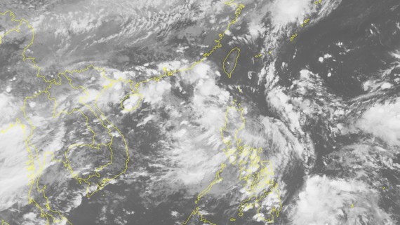
At 1pm on August 31, the eye of the tropical low pressure system was located at the Philippines’s Luzon Island with sustained winds of 40-50 kilometers an hour.
In the next 24 hours, this dangerous zone would continue moving westward, and be centered at around 550 kilometers from the Paracel Islands.
By 1pm of the following day, the system will be swirled at 18.9 degrees north latitude and 111.8 degrees east longitude near the Hainan Island of China.
Within the next 48-72 hours, the storm is forecast to turn west- southwestward at its speed of 15 kilometers an hour.