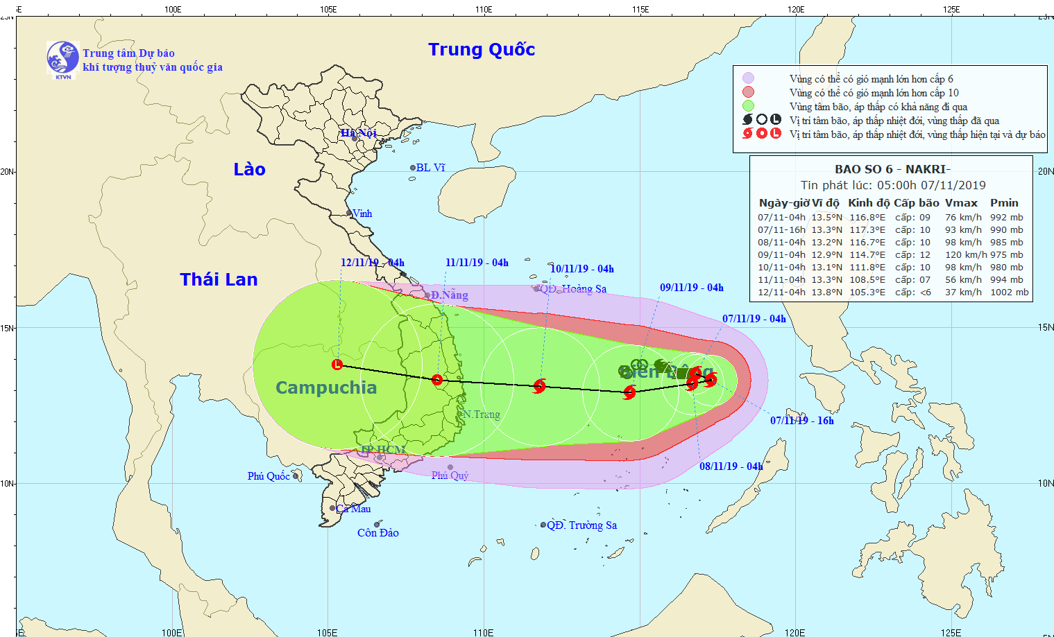
At 4m today, typhoon Nakri was centered at around 340 kilometers from the Southwest Cay islet of the Spratly Islands with the maximum wind of 75- 90 kilometers per hour.
Within the next 24-72 hours, the dangerous zone is expected to move eastward and westward respectively at its rapid speed of 5- 15 kilometers. In the next couple of days, the tropical storm is forecast to turn into a tropical low pressure system.
The weather agency issued prediction for the typhoon, which would strike land in the above localities from the daytime of November 10 to the early morning of the following day.
According to Director of the National Hydrology Meteorology Forecast Center Mai Van Khiem, Nakri would become this year’s strongest typhoon if its intensity reaches level 11.
Nakri tends to gain strenth because it is located in warm water, which results in the favorable dynamic conditions of intensive convergence, and is additionally influenced by continental high pressure system spreading out southern region in combination with cold air mass from the northern region.
As forecast, heavy to heavy downpours will cover the coastal provinces and cities from Thua Thien- Hue to Phu Yen, and the eastern part of Gia Lai and Kon Tum provinces with an excessive rainfall of over 100 mm.
Related news
Other news

Vessels need to proactively respond to storm Dujuan

Storm Dujuan to churn towards Paracel Islands

Hazardous weather warned in sea

Ultraviolet index in Southern region to reach high harmful level in next 3 days

Snow, ice fully cover on top of Fansipan mountain

Country to enjoy nice weather during Tet holiday

North to suffer from hail, lightning before Tet holiday

South enjoys milder weather than Northern region in advance Tet holiday

Gelid cold returns Northern, Central regions
