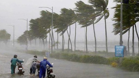
At 5am today, its eye was at 20.6 degrees north latitude and 106.5 degrees east longitude of the northern mainland provinces from Hai Phong to Nam Dinh, with its violent winds of level 6- 11.
Within the next 24 hours, this dangerous zone is expected to move west- northwest at 10-15 kilometers an hour, enter the Northwestern mainland provinces before respectively turning into a tropical depression and a low- pressure zone in the northern mountainous and midland regions.
This early morning, the Gulf of Tonkin including Bach Long Vi, Co To, Cat Hai and Van Don island districts experienced gusty winds of level 6-11 and rough sea.
Because of the hurricane influence, provinces between Thanh Hoa and Nghe An continue having heavy downpours with an average rainfall of 40- 80 mm, even up 100- 150 mm during 24 hours.
Medium- heavy rains and thunderstorm spell are warned in the capital city of Hanoi.
After the heavy rainfall, high risks of flash flood and landslide are still warned in the mountainous areas of Lao Cai, Dien Bien and Lai Chau.


