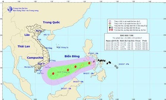
The tropical storm is warned to move the west- southwestward at a speed of 20 kilometers an hour within next 24 hours.
By 1pm tomorrow, it is going to be at around 270 kilometers of the south- southeastward of the Southwest Cay Island. The strongest wind near the center could gust 60-75 kilometers per hour.
Because of its influence, the eastern, the central and south areas of East Sea are warned to experience showery weather, thunderstorm, powerful wind of level 6-7 and sea rough.
The dangerous zone is paralleled at 7.5- 12.0 degrees north latitude and 114.0 degrees east longitude within next 24 hours.
In next 24- 72 hours, Kai-tak will continue moving the west- southwestward at a speed of 10- 15 kilometers an hour; and it is forecast to powerfully upgrade.
 By Wednesday afternoon, its eye will be at around 170 kilometers of the eastward of the Spratly Islands.