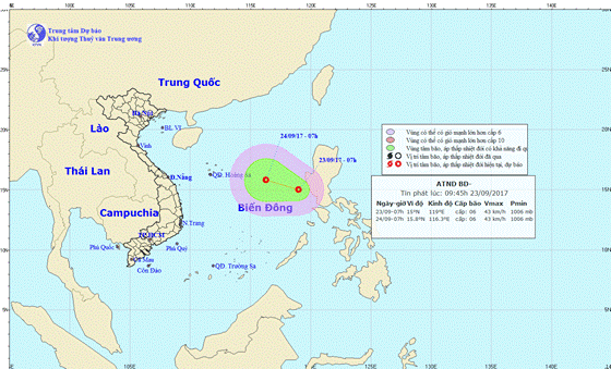
At 7am, the tropical low depression was located at 15- 19 degrees east longitude with its strongest wind near the center gusted 40- 50 kilometers an hour.
In this early morning, it was located at 17.8 degrees north latitude and 115.5 degrees east longitude with its peak wind speed at 40-60 kilometers an hour.
Within next 24 hours, the depression is predicted to move the west- northwestward at 20 kilometers per hour.
By 1am tomorrow, its eye will be at 20.2 degrees north latitude and 110,2 degrees east longitude of the northern territorial water of Hainan Island (China). The strongest wind near the center will blow level 6-9 and sea rough.
The dangerous zone will be at 16- 21 degrees north latitude.
Because of an influence of depression convergence and its circulation, the northern territorial water and mid- East Sea including the Paracel Island, the territorial waters from Binh Thuan to Ca Mau, from Ca Mau to Kien Giang provinces and Gulf of Thailand will see showery weather, thunderstorm, cyclone and strong wind of level 7-8.