Within following 24 hours, it is expected to move the westward at a speed of 30- 35 kilometers per hour and is going to upgrade stronger.
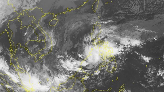
By 7pm today, its eye will be at around 9.2 degrees north latitude and 118.7 degrees east longitude, at around 100 kilometers of the eastward of the Philippines’ Palawan Island. The strongest wind near the center could gust at 50- 60 kilometers.
The tropical depression will continue quickly moving the westward at a speed of 25 kilometers an hour, and it is forecast able to develop into a storm in next 24- 48 hours.
This morning, the National Steering Committee on Natural Disaster Prevention and Control and the National Committee for Search and Rescue asked the coastal provinces and cities from Da Nang to Kien Giang, the Ministry of Defense, the Ministry of Transport, Foreign Affairs Ministry, Natural Resource and Environment Ministry and the Agriculture and Rural Development Ministry to announce occurrence of the tropical depression.
The functional agencies required relevant provinces, cities needed to constantly update and provide information of the powerful tropical depression to fishing vessels in sea.


