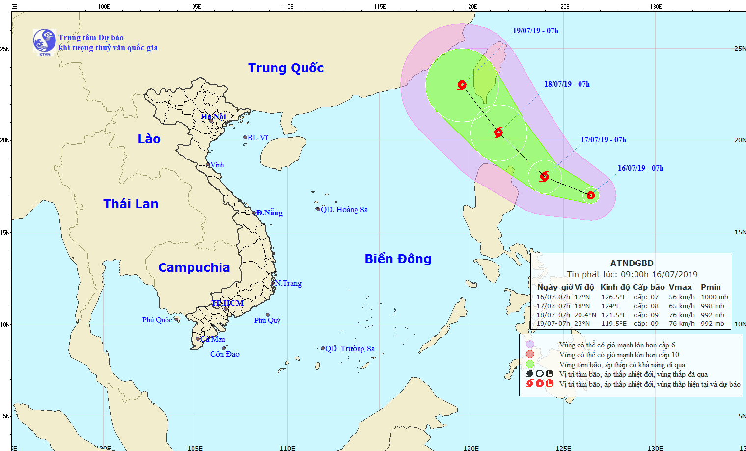
This early morning, its eye was located at around 440 kilometers of the eastern territorial water of the Philippines’s Luzon Island, with a maximum wind speed of 40- 60 kilometers an hour.
During next 24 hours, the dangerous zone is able to turn into a tropical typhoon, moving 10- 15 kilometers an hour.
By 7am tomorrow, the storm will be centered at around 200 kilometers from the Luzon Island.
Within next hours, the tropical typhoon is forecast to operate stronger and move the north- northwestward at 15 kilometers an hour.
The weather agency mapped on the typhoon’s position towards territory of Taiwan .
As forecast, the powerful operation of the Southwest monsoon in combination with upper wind convergence at altitudes above 5000 meters will interact with the storm, triggering bad weather conditions of rainy spells, cyclone and thunderstorm on sea.
Because of an influence of the Southwest monsoon, the territorial waters from Binh Thuan to Kien Giang, the Gulf of Thailand, a part of the middle and the south- East Sea and the Spratly Islands face severe weather of showers, cyclone, violent wind, thunderstorm and rough sea from Tuesday.


